360 Property Data
CoreLogic powers businesses with unrivaled property data, insights and technology.
Explore Our DataCoreLogic powers businesses with unrivaled property data, insights and technology.
Explore Our DataDifferentiate with insights and analysis from CoreLogic property data.
Know MoreProperty. People. Potential. CoreLogic unlocks value for the entire property ecosystem.
Learn MoreHome / 360 Property Data / Location Intelligence Growth
Historically, finding new growth areas using location intelligence, and analytics required demographic projections that were based on vintage data, and therefore, lacked an up-to-date understanding of what was happening on the ground today. Not anymore. By leveraging our daily updates of property information, we use CoreAI to reveal near real-time events for a better understanding of future real estate developments.
Utilizing our portfolio of location data, CoreLogic captures the sequence of land in transition by revealing the key indicators or “signals” of regional growth activity. When, for example, a real estate developer or a home builder purchases land, CoreLogic can identify the date of this transition. This information can be valuable for supporting the development of capital expenditures, which require longer lead times.
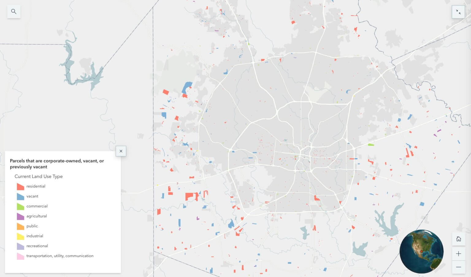
Next is the transition between land use categories, such as a classification from “vacant” to “residential.” This change becomes even more significant over time as we expect to see a transition from “residential” to property designated as “single family residence.” The map here illustrates the dispersion of land use in Bexar County, Texas, in and around San Antonio where property is in transition.

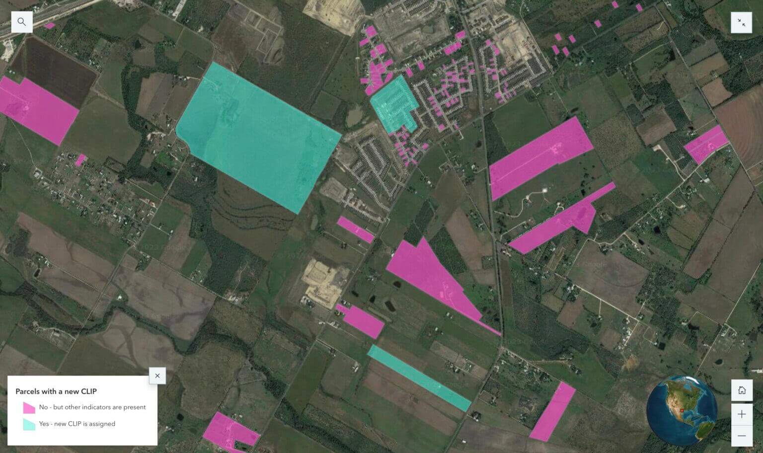
The next likely step in the transition process occurs when land is subdivided into individual properties. This can potentially provide information that development is underway. To further confirm, you may see each new property getting a new address. CoreLogic Location Intelligence captures these activities from multiple government sources, including tax assessor, and this additional property information may be assigned a CoreLogic Integrated Property (CLIP) identification number.
Subdivision of land is followed by assignment of new postal addresses. CoreLogic can track such developments, and may also find that the land use code has changed from a “residential lot” to “single family residence.” With multiple such indicators, the historical record of “land in transition” begins to take shape. The map below illustrates how consumers of this data can isolate areas for further review of potential investment opportunities.

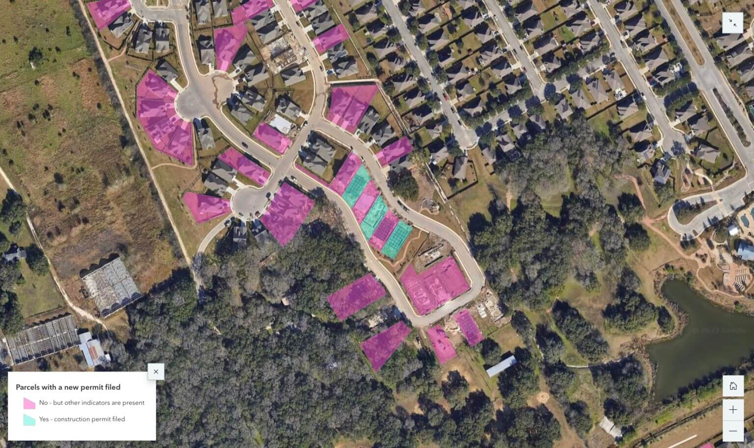
The application of a building permit generally preludes the imminence of a real estate development. CoreLogic, with updated data and the ability to find areas of active real estate development, provides a “first-mover” advantage to organizations looking to both make sound infrastructure investments, and get ahead of their competition. The map here illustrates how building permit data determines both the areas of upcoming construction and future residential developments.

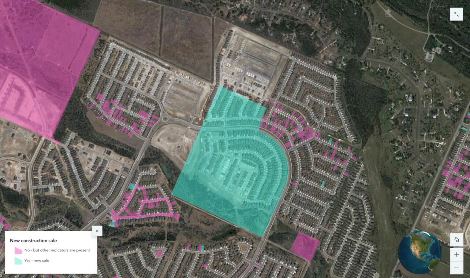
Whether you’re a wireless provider looking to install new cell sites to accommodate increasing data volumes and maintain service level agreements, or you’re a commercial retailer assessing retail sites to support the growing population, knowing that sales are underway is a sign to consider in your decision-making. And, CoreLogic captures the “counts” of all sales within a two-mile area. The map here captures an area of new construction sales as well as areas where additional indicators are present that may signal future residential developments.

Telecommunication companies must be vigilant in pinpointing emerging growth areas to retain a competitive advantage and meet increasing demands in broadband connectivity. Unfortunately, traditional site location methods fall short of identifying where growth is likely to occur and lack essential data for informed infrastructure investments.
To overcome challenges associated with rapid technological advancements, increased connectivity demands, and constraining infrastructure deployment requirements, telcos must bridge the gap between outmoded methods and the growing need for proactive, data-driven decision-making. By leveraging key location-based data, the modern telecom industry can meet its demands while ensuring long-term competitiveness and customer satisfaction.
Telco providers should be aware of areas that are slated for development to avoid overloading their networks by adding a new site or improve existing cellular and data coverage to maintain service level agreements. Similarly, telco companies are some of the first that that need to know if there is a need for additional infrastructure to efficiently allocate capital investments and acquire human resources to begin supporting a growing region.
CoreLogic’s Location Intelligence Growth leverages location-based data and property attributes to accurately identify areas with high growth potential and empower clients to to use business intelligence and make well-informed decisions as well as optimize their strategic investments.
Cities, municipalities, counties, and other regions are constantly undergoing change. This is often reflected in how land is acquired, developed, and improved. Our Growth solution offers valuable location data and information on evolving land. It also provides predictive modeling and data visualizations to assess the probability of new residential development.
Traditional site location methods frequently fall short due to their lack of essential data and leading indicators of growth. CoreLogic’s property data intelligence captures data in weekly or monthly increments to provide a near real-time assessment of a region’s growth potential.
Stay connected and up-to-date on Location Intelligence Growth.
Complete the form below and our team will follow-up soon.